
51
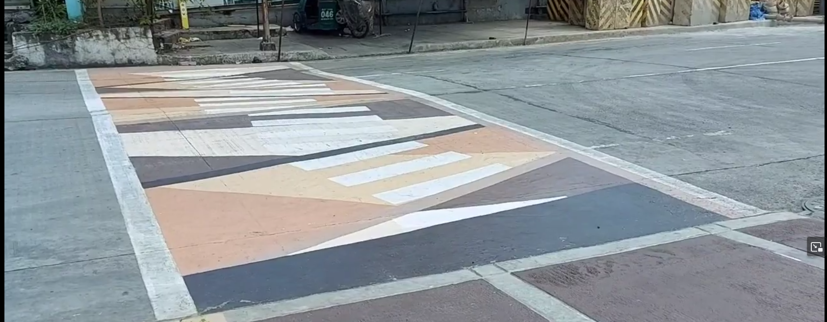
A nearby city call these crossings as "Gora¹ Lanes", an attempt to make walking fun, attractive, and accessible to more people.
(cdn.masto.host)
A nearby city call these crossings as "Gora¹ Lanes", an attempt to make walking fun, attractive, and accessible to more people.
From the screenshot² below, it's something like an arty zebra (or "continental") crossing, and I saw minimal use of crossing:markings=artwork in #OpenStreetMap, and taggable with crossing:markings=yes.
I wonder how you folks might tag it.
¹ - Gora is an acronym from "Green Open Reclaimed Access"
² - Source: screenshot, https://yewtu.be/lKMFjLcTVkQ?t=59
@MapAmore @openstreetmap crossing:markings=artwork seems a good key. crossing:markings=yes is too generic, IMHO
@mannivu
I agree. It's typical in OSM to use a generic "yes" when a mapper isn't sure about the "right" value just yet, and get back to it later, or maybe the next mapper can figure out a better value.
That's a specific case when I find the image=*, or mapillary=* tags and the like, very helpful. Usually, these are used to tell other mappers what the previous mapper saw from the photo.
In JOSM these are turned into links you can view, but not sure how it works in iD.
@openstreetmap
@MapAmore @openstreetmap just checked, and if you add an image= tag you get a clickable link in iD too
@mannivu @MapAmore @openstreetmap
🤔
@SeeandMap @MapAmore @openstreetmap I know, I know, it was just a test. I knew where to find a POI with a linked Commons File and pasted the URL in the image tag, but I didn't save it 😉