1
1
Real median wealth per adult (2022)
(datawrapper.dwcdn.net)
Map on wikipedia
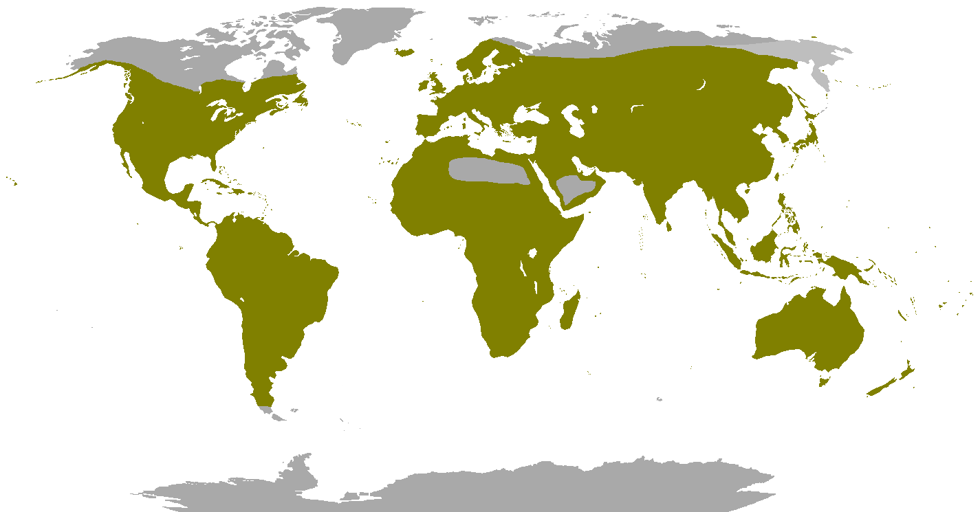
Based on information and maps from The Encyclopedia of Animals: a complete visual guide
This is my favourite map projection and maybe now it can be yours, too!

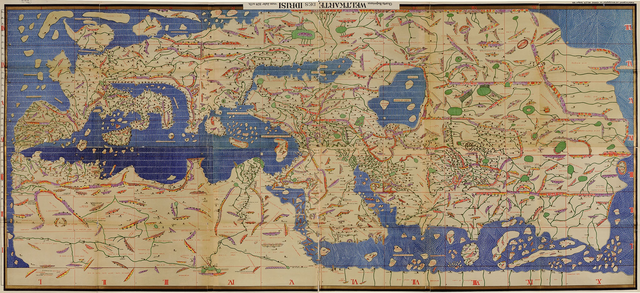
Map description (from 2009):
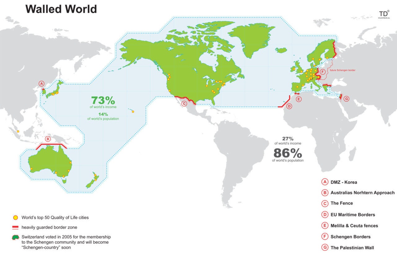
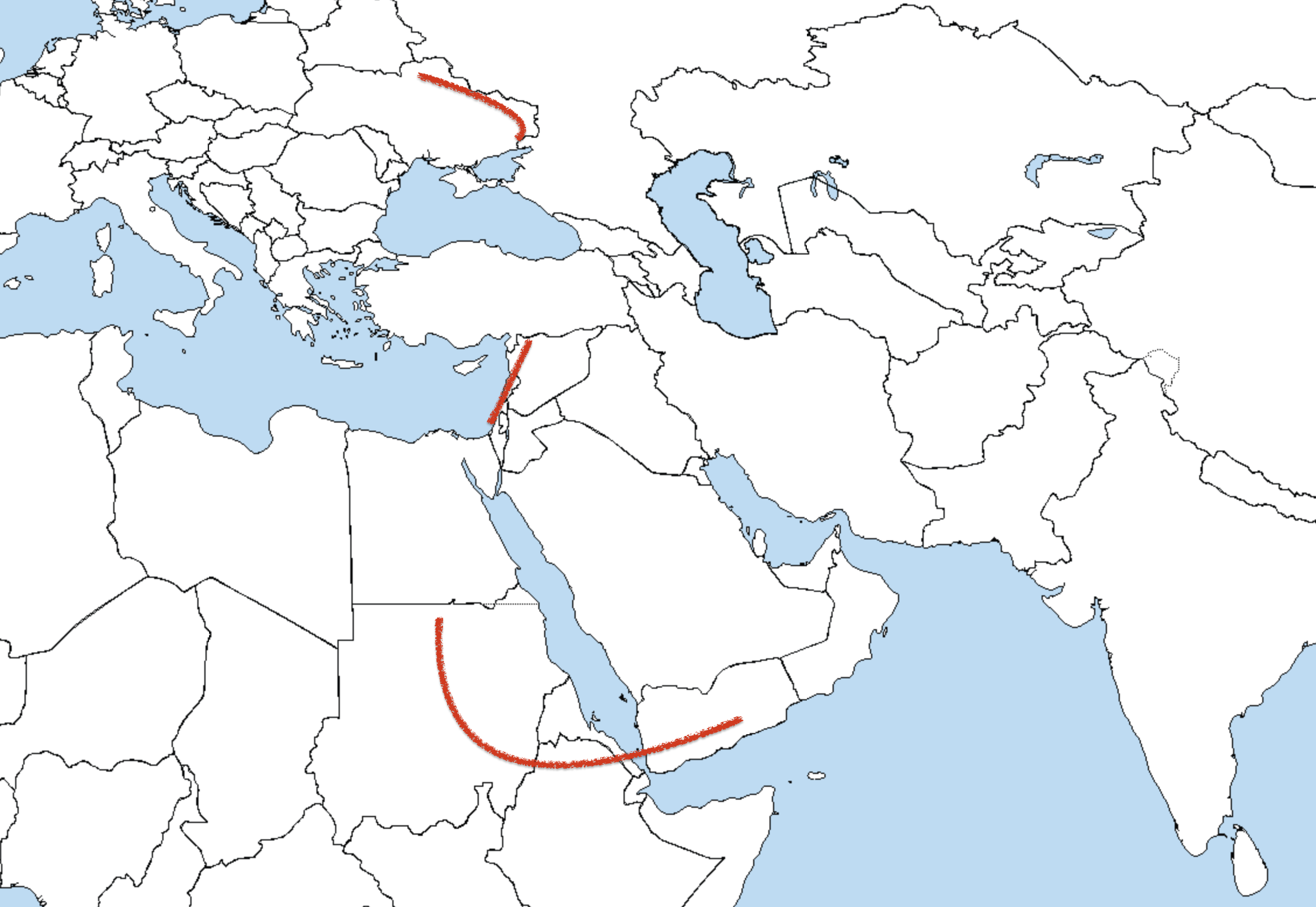
A) The Demilitarised Zone (or DMZ) In Korea is a strip of land running across the Korean Peninsula that serves as a buffer zone between North and South Korea. The DMZ was created in the ceasefire of July 27th 1953 and cuts the Korean Peninsula roughly in half. It is 248km long and approximately 4km wide.
B) The Australian Defence Force (ADF) conducts surveillance and response operations in Australia’s northern approaches. Since September 2001 it doubled the number of days Customs vessels are at sea and increased flying hours for surveillance aircraft by 20 percent. Under a proposed legislation from June 2006 all new boat arrivals would be transferred offshore to have their asylum claims processed. In May 2009 the Ministry of Defence laid out a plan for an enlarged navy to conduct independent military operations.
C) The United States-Mexico barrier is actually several separation barriers designed to prevent illegal immigration into the United States. The 3,140km border between the United States and Mexico traverses a variety of terrains, including urban areas and deserts. The barrier is located mainly in the urban sections of the border which include San Diego, California and El Paso, Texas. Between 1995 and 2004, 1,954 persons are officially reported to have died along the US-Mexico border. According to No More Deaths, 1000 bodies of migrants have been discovered in the southern Arizona desert between 2004 and 2006. The ‘Secure Fence Act of 2006’, enacted in October 2006, allows for over 1100km of double-reinforced fence.
D) The Melilla border fence is a separation barrier between Morocco and the Spanish city of Melilla. The razor wire barrier cost Spain €33 million to construct. It consists of 11km of parallel 3m high fences topped with barbed wire. Its height was doubled to 6m.
E) Schengen Border is an agreement among European states which allows for common policy on the temporary entry of persons and a border system. A total of 31 countries - including all European Union states except the Republic of Ireland and the United Kingdom, but including non-EU members Iceland, Norway. and Switzerland - have signed the agreement and 25 have fully implemented it so far. The Republic of Ireland and the United Kingdom did not sign the Schengen Agreement but take part in the Schengen co-operation and use the Schengen information system for law enforcement purposes.
F) The West Bank barrier is a physical barrier being constructed by Israel consisting of a network of fences with vehicle barrier (trenches?) surrounded by an on-average 60 metres wide exclusion area and up to 8 metre high concrete walls. As of January 2006 the length of the barrier as approved by the Israeli government is 670 kilometres. Approximately 58% has been constructed, 9% is under construction and construction has not yet begun on 33%.
The Ceuta border fence Is a separation barrier between Morocco and the Autonomous City of Ceuta in Spain. Construction of the €30 million razor wire barrier was financed by the European Union. It consists of parallel 3-metre fences topped with barbed wire.

